Kamal
Tool
Medieval
Quick Facts:
Used to indicate the distance traveled north or south, the kamal was used to guide Arab ships to port. It led to the later development of the cross-staff.
Introduction
The kamal is one of the earliest navigational tools that used measuring altitude to determine latitude. The word kamal means “guide” in Arabic.1 Introduced to the Europeans by the Arab people, the kamal was useful in determining altitude, and lead to the development of newer tools such as the cross-staff. Famed explorer Vasco da Gama’s experienced navigator used the kamal to help them navigate around the tip of Africa as they sailed to Asia.2
History
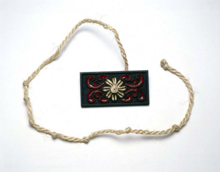
The kamal was the preferred navigational tool for ancient Arab sailors. Early Arab navigators relied on the stars for seafaring. They traveled throughout major bodies of water including the Indian Ocean, Mediterranean Sea, Red Sea, and Persian Gulf. Before the kamal, Arab navigators determined latitude by measuring the elevation of the Polaris (the North Star) by using their hand.3 This method helped them determine an approximate degree and location, but was not always effective. But the knowledge of determining latitude lead them to develop the kamal. Essentially, a kamal is a flat piece of wood with a string attached to the middle.4 The kamal uses the position of Polaris (the North Star) in the sky to help a sailor determine his latitude.
The height of Polaris in the sky depends on a person’s location on Earth, so by measuring the height of Polaris, a sailor could tell where on Earth he was standing. While it is not completely known when the kamal was invented, similar instruments were used before the 16th century.5 As trade and travel between Europe and the Middle East increased, so did the sharing of ideas. The idea of the kamal began to be used by Europeans. Eventually, the cross-staff became the popular tool for the Europeans. But the concept of this tool came from the kamal.
How It Works
Arab navigators preferred using the North Star for navigation. Using a kamal requires a point of reference. This would usually be the port that a sailor would be starting his journey from. So how does it work?
Before leaving, the navigator would tie a knot in the cord, hold the knot between his teeth while holding the wooden piece out vertically. The cord would be pulled taut and upwards to line it with the North Star. They would sail either North or South, and would measure the North Star along the way. When the North Star and horizon lined up along each end of the kamal, the sailor would maintain that latitude.6
Endnotes
- Linda D. Williams, Navigational Aids (Tarrytown: Marshall Cavendish Benchmark, 2008), 15.
- Shihan de Silva Jayasuriya, The Portuguese in the East: A Cultural History of a Maritime Trading Empire (New York: Tauris Academic Studies, 2008), 1.
- Donald Launer, Navigation Through the Ages (New York: Sheridan House, Inc., 2009), 14-15.
- Williams, Navigational Aids, 15.
- Cynthia Clark Northrup, ed., Encyclopedia of World Trade: From Ancient Times to the Present: From Ancient Times to the Present, Volumes 1-4 (New York: Routledge, 2005), 251.
- Launer, Navigation Through the Ages, 15.
Bibliography
Jayasuriya,Shihan de Silva. The Portuguese in the East: A Cultural History of a Maritime Trading Empire. New York: Tauris Academic Studies, 2008.
Launer, Donald. Navigation Through the Ages. New York: Sheridan House, Inc., 2009.
Clark Northrup,Cynthia ed. Encyclopedia of World Trade: From Ancient Times to the Present: From Ancient Times to the Present, Volumes 1-4. New York: Routledge, 2005.
Williams,Linda D. Navigational Aids. Tarrytown: Marshall Cavendish Benchmark, 2008.
Gallery
- Kamàl, reproduction, 1977, by Nautica, Peter Ifland Collection, The Mariners’ Museum, (1998.39.7).
- Kamal (courtesy The Mariners’ Museum collection – catalog# 1998.0039.000007)
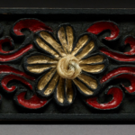
- Kamal close up showing carving and lacquer (courtesy The Mariners’ Museum collection – catalog# 1998.0039.000007)
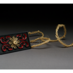
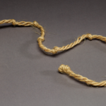
- Kamal string ((courtesy The Mariners’ Museum collection – catalog# 1998.0039.000007)

